
Exploring Geosite Geopark Batur: A Journey into Bali’s UNESCO Lava Rock Legacy
Hi, I’m Jason, a Business Journalist at Bukit Vista, and in today’s feature from Bali Business Review, I’ll be taking you on a journey across one of Bali’s most awe-inspiring natural landmarks — the Batur Geopark. This protected UNESCO Global Geopark is more than just a hiking destination; it’s a geological wonder sculpted by volcanic eruptions dating back to the 19th century. Join me as we delve into the raw power of nature and the mesmerizing aftermath that lives on as Mount Batur’s cooled lava formations.
What is Batur Geopark?
The 1849 Eruption: A Defining Moment in Bali’s Geological History
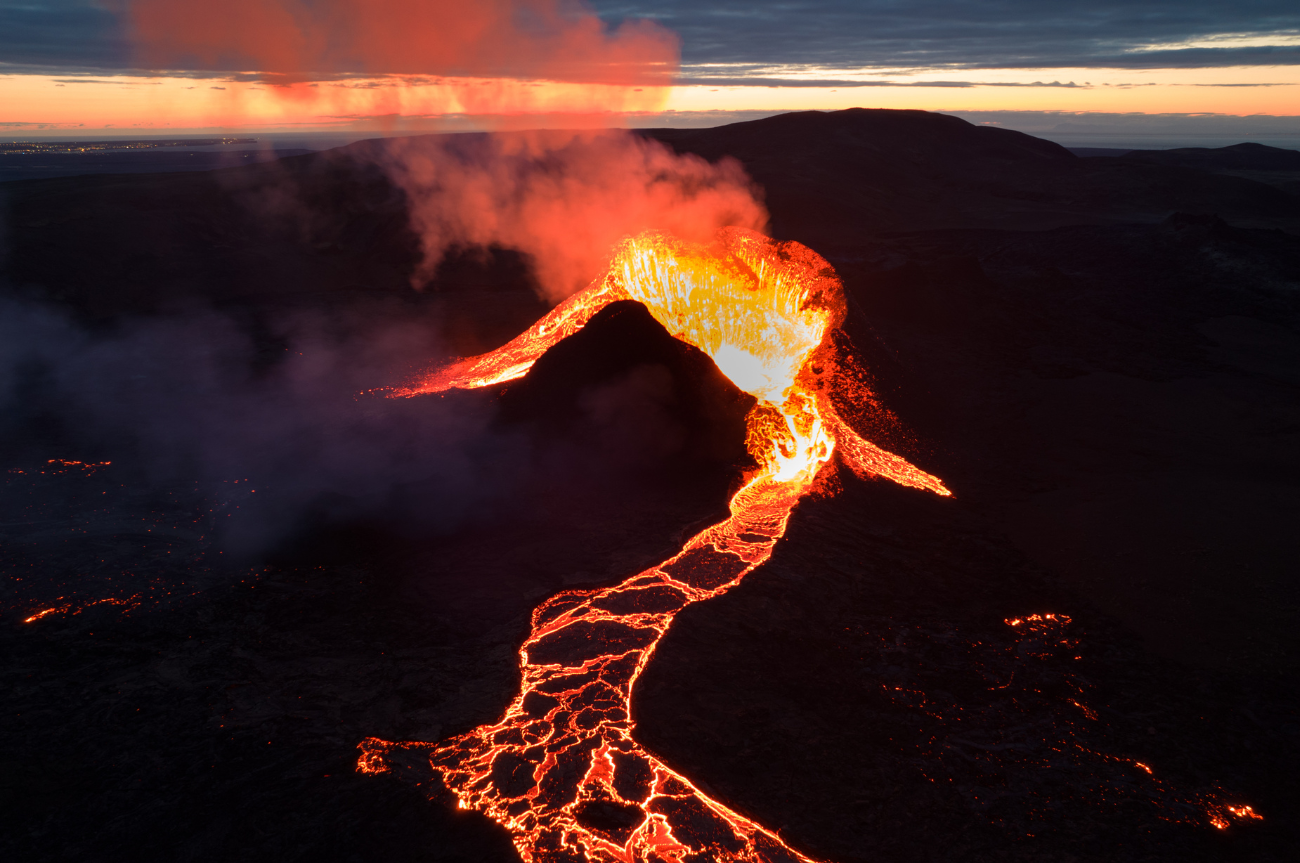
The story of Batur Geopark begins with an event that forever altered the landscape: the eruption of Mount Batur in 1849. Unlike explosive eruptions that send ash clouds into the sky, this was a fusive eruption, meaning it poured out rivers of molten lava instead of blasting the top off the volcano.
As I stood among the rugged terrain, I could see the evidence of that moment frozen in time. Massive black-rock formations stretch across the horizon, blanketing the earth with layers of solidified lava. The fascinating texture and shape of these formations were created when the lava cooled rapidly upon contact with the cooler air — a stunning example of nature’s contrasting forces at work.
Why UNESCO Recognition Matters
The Batur Geopark’s designation as a UNESCO Global Geopark isn’t just a title — it’s a commitment to preserving and promoting geological heritage through sustainable tourism, education, and conservation. This means visiting the geopark is not only an Instagram-worthy day trip but also a chance to appreciate and support environmental stewardship in one of Bali’s most fragile and fascinating ecosystems.
With its ancient caldera, scenic crater lake, and wide lava fields, Batur Geopark offers a living classroom. Visitors can learn about tectonic movements, volcanic activity, and how natural disasters like eruptions have shaped both the geography and culture of the region.
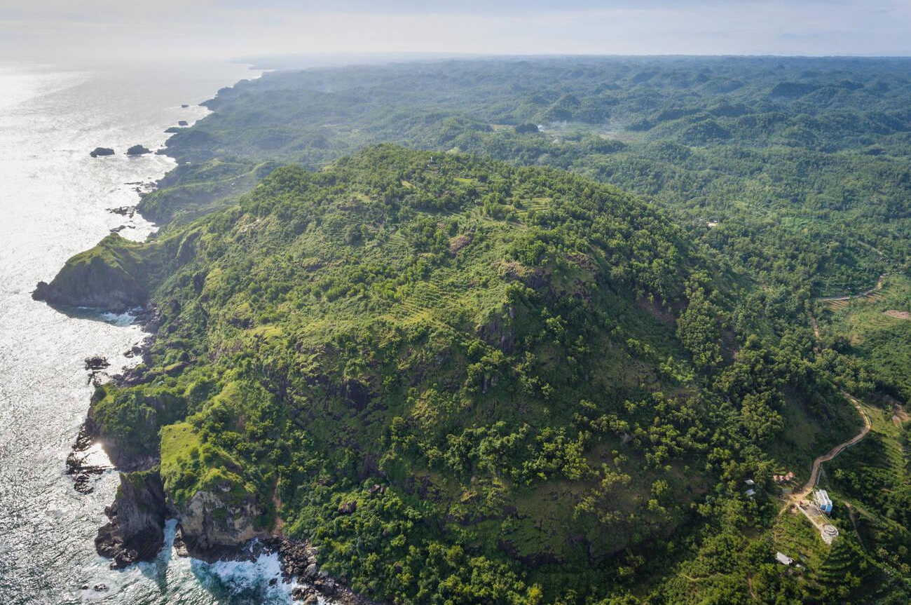
Lava Fields that Tell a Story
Walking through the geopark, you’ll find yourself surrounded by vast lava fields that look like something out of a sci-fi movie. Formed by the intense lava flows from Mount Batur’s eruption nearly two centuries ago, these formations are more than just rocks — they’re history etched into the land.
- Black lava rocks as far as the eye can see
- Unique geological formations created by rapid cooling
- Close proximity to Mount Batur for sweeping panoramic views
For geologists, photographers, hikers, or curious travelers, standing amongst these ancient rocks is an unforgettable experience. It helps frame our understanding of how powerful the Earth can be, and how such power can create enduring beauty.
The View from the Geopark
As I gazed across the landscape, what struck me most was how serene and hauntingly beautiful it all appeared. You can literally stretch your eyes across the horizon and see nothing but lava rock — evidence of destruction that, over time, has sculpted one of Bali’s most iconic destinations. Dominating the backdrop is the majestic Mount Batur itself, standing as both a reminder of past volatility and a symbol of resilience.
Discover Batur Geopark for Yourself
Whether you’re a geology enthusiast, a nature lover, or just looking to experience something uniquely Bali, Batur Geopark is a must-visit. It offers a profound reminder of the island’s volcanic origins, all while showcasing the grandeur of Earth’s ever-evolving surface.
If you’re curious to see this incredible location firsthand and hear my full experience, watch the full video here:
Until next time, this is Jason, Business Journalist at Bukit Vista, bringing you more stories from the ground here in Bali.